

Digital navigation has changed the way people travel. But what happens when the technology fails?
Keep left at the fork.
Maegan Ackerson, a senior Ball State University student, is accustomed to lengthy drives following a GPS. To be exact, she drives 14 hours from Trophy Club, Texas, to Muncie.
She has music playing, rocking out to “I Like Me Better” by Lauv. The radio stations are inconsistent during the city-spanning drive. The roads are crowded, and there’s an influx of people driving to the many colleges in Dallas.
Keep straight for the next 100 miles.
Maegan drives nearly six hours from her home in Trophy Club to Arkansas without GPS. However, with so many possible ways to go, she depends on her GPS for further navigation. For most, the concept of driving 14 hours for college may seem ludicrous. But Maegan doesn’t regret choosing Ball State.
“This university has given me so much that it does not compare to the crummy drive that I have to take,” she says. “The scenery is absolutely beautiful and it makes me realize that I am going to a great school and that I have so many great places that stood in between me and the school that I was going to. That felt really reassuring, especially being so far from home.”
Despite her growing confidence for the drive, Maegan still needs her GPS. There aren’t a lot of landmarks, and there are so many miles between cities and her final destination. She drives through farm towns for miles and miles of open land.
“I highly depend on my GPS,” she confirms.
And she’s not the only one.
In 2018, 54% of respondents aged 18 to 29 years stated they used their cell phone for maps or GPS navigation, according to a study by Statista.
Technology has brought vast improvements to our everyday life: We have computers at work, cell phones in our pockets, tablets in our children’s hands, and earbuds tucked in with music blaring.
According to Pew Research Center, 96% of Americans own a cellphone of some kind, 81% own a smartphone. Nearly three-fourths of U.S. adults own a desktop or laptop computer, half own tablet computers or e-reader devices.
However, what happens when this technology is not available to us?
“When I go places and do not have service on my phone, I often panic because I cannot use my GPS and cannot call anyone for help if I am lost,” Maegan says.
Her mother accompanied her for the drive from Trophy Club to Muncie for her junior year. Everything was normal until Maegan began to notice the GPS highlighted a different, more scenic route for their drive. Little stores, run-down “mom and pop” shops, ancient model cars and diners. Plus some cha-ching casinos along the way.
We are very much going the wrong way.
It’s too late, Maegan. Let’s do this; it’ll be an adventure!
They were two hours into the drive and the highway was nowhere in sight.
For four hours, they journeyed through small towns before merging back onto the highway—known territory. Since then, Maegan has not had such complications, and knows her way with finesse.
However, not everyone is so captivated by GPS and its convenience.
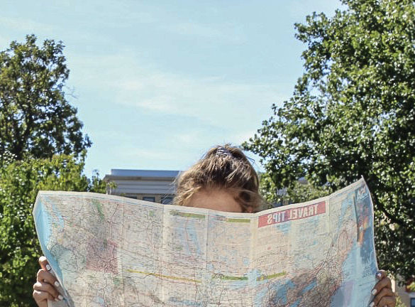
Jörn Seemann, assistant professor of geography at Ball State, focuses on the relationship between maps and culture. He defines maps as graphic forms of communication. They can help develop the understanding of places and concepts.
As a cultural geographer and a cartographic educator, Seemann has loved maps since he was young. Particularly fond of historical maps, he enjoyed the intricacies of maps—their hidden messages, the way political worldviews could be reflected on them, and what the world once looked like.
However, the maps he cherished as a child have changed forms, transitioning from paper maps and atlases to phones and GPS.
On our devices, the user can zoom in and out, navigate down the street, turn and look at the surroundings as if they are physically in the space. Maps, on the other hand, are static and may be outdated. A map from 2000 will not be updated and apply to travel in 2019.
However, GPS poses a problem as well. There is no guarantee digital maps will always be available. As in Maegan’s case, should there be a lack of service, there is no way to access a digital map for help.
Maegan understands that complication, and has expressed her concerns at not knowing how to read a map properly. Her parents both rely heavily on GPS. Her grandparents, on the other hand, are highly dependant on their outdated maps and are resistant to shifting to GPS.
“My grandma once told my boyfriend that the place that we were going backpacking did not exist because it wasn’t published on her 2006 Atlas,” Maegan says, recalling an event from last year. “She is totally against letting go of her 12-year-old map.”
Adding to the resistance, her grandparents live in a Montana mountain range, where phones lack service in many areas.
Seemann says he prefers researching his route on Google Maps, printing them out and following the printed directions. He has a reason for this, too.
“When people simply follow the instructions, they stop thinking. They put their trust in technology and do not develop spatial skills,” Seemann says.
Despite the potential consequences to digital maps, GPS maps are useful for long road trips such as Maegan’s experience.